

A Trail, a Treaty and a Church
A Trail, a Treaty and a Church
The many layers of place
Hello and welcome to the ninth issue of Place. Today we’re headed to the foothills of Canada’s Rocky Mountains to explore the layered landscape and trails that have constituted “placemaking” for thousands of years. Kylee follows a path along her family’s property - guided by water, made by migrating animals, worn by First Nations, and finally taken over by White settlers - and explores a controversial fire in a church in a nearby town, to understand what happens when a place does not reflect everyone, and when one form of placemaking is prioritized over another.
At Place, we believe that the experiences, sensations and conversations we have as we move about the world stay with us, stacking up as the years go by, forming who we are and the way we view the world. Do you have a letter to share? Send it to us at placeletter@protonmail.com. If you are interested in writing for Place you can find our inaugural pitch guide here. And be sure to follow us on Instagram @placenewsletter for a daily visual feast. Yours, The Place editorial team.
What Remains
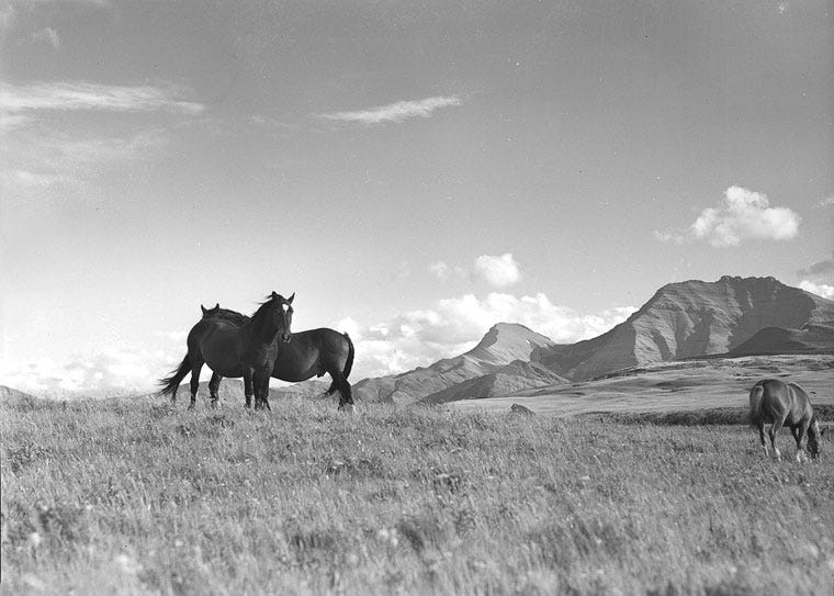
In the forest behind the farmhouse I grew up in, at the foot of Western Canada’s Rocky Mountains, lies an old wagon trail. My father and I would turn onto it when we rode our horses down into the valley that runs parallel to our property line, hooves in an ancient tract. We’d stay on the trail for a half mile or so before going off the path, horses working harder, picking the usually circuitous route of least resistance around fallen poplar tree trunks.
The horses always perked up on the wagon track. They have a way of knowing about a path that's been taken before. Their ears would flick forward, nostrils flared slightly, sometimes stopping a second or two to consider what lay ahead: The fuzzy space where tree and track became one, the darkness that nestled there.
I too would become alert crossing the threshold of the wagon trail. I was obsessed with the Little House on the Prairie books as a child, a series about a homesteading family in Minnesota. I sometimes imagined my family as the modern day equivalent, but with electricity and gasoline, sans homemade head cheese. I’d turn to look behind us as we trotted along, my spine swaying with each hoof step, thinking that at any minute a canvas covered wagon would appear from the dark green forest.
Of course, before the wheels of settlers' wagons indented grooves into the mouldable ground, First nations walked that same trail. They were the original placemakers of this landscape, dating back to when the earth was young and settling into its contours.
“They would have followed the creek,” my dad would say as we rode along the wagon trail, pointing a finger towards the soft trickle of water we’d already crossed. My dad, a hunter and tracker, imparted on me the innate importance of orientation - where to walk when there is no trail, and how to find one.
But to do this you have to understand the ways that trails are made. First there is the landscape itself: tectonic plate formation, sedimentary buildup and erosion, the way water flows from glaciers and - on this side of the Rocky Mountains - heads southeast towards the prairies. I learned that the shape of the earth and the movement of water determine the movements of all living things. The animals make the first tracks. Mice superhighways turn into routes used by deer and moose, bears and cougars.
The human paths come last. By the time European settlers invaded Canada, First Nations had already mapped out this country through networks of footpaths centered around resource rich corridors and the seasonal patterns of weather and animals. Here in Southern Alberta, the way making of the Plains Indigenous people would have mirrored the movement of buffalo herds, out onto the prairies and back to the base of the Rockies. On their way, they would have passed through the valley behind my family’s farmhouse.
Before European settlers tried to erase the habits of those indigenous to Turtle Island, now called Canada, they learned about this place through excursions on First Nations footpaths, guided by chiefs themselves. The majority of highways, gravel roads and even fence lines in Southern Alberta today are based on these pathways.
Settlers cemented their own trails. Great tracts of land, the lungs of a once great ecosystem of migration, were sold as private property, or set aside as public parks (which, in some cases, Indigenous people in Alberta were barred from entering for some time).
My mom and dad bought one of those parcels, cleared over a mile of trees for a driveway, moved into a mobile home on the land, and completed construction on a house seven years later. They put in a garden at the top of the valley, rows of potatoes and carrots growing half a mile away from an old wagon trail in the forest, first traversed by the Stoney-Nakoda Indigenous people.
A new place had been made, but on top of what?
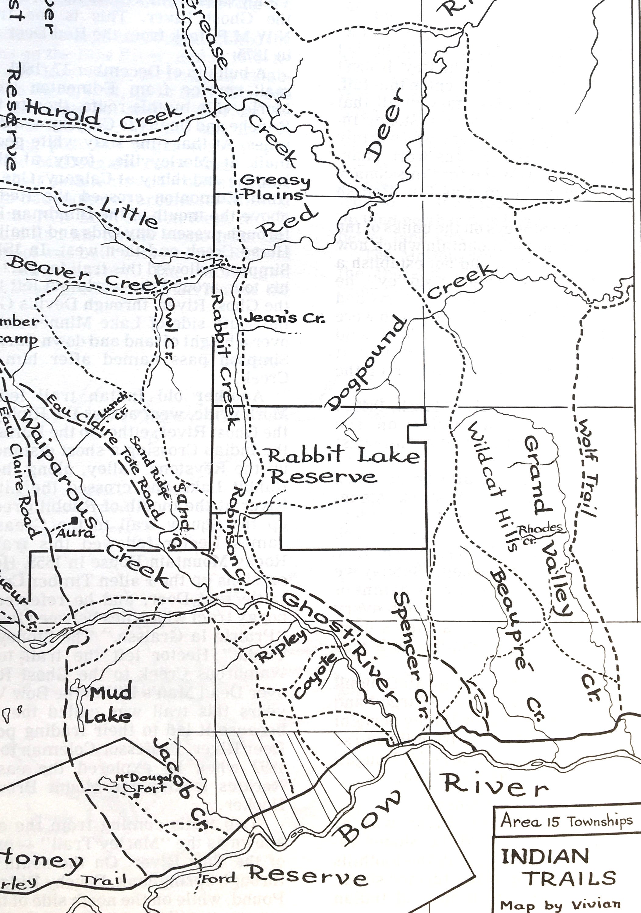
photo courtesy of Cochrane and Area Historical Society
Roughly 15 miles from our farmhouse, on the side of a single lane highway heading west into the Rocky Mountains, was a white one-room church, called the McDougall Memorial United Church.
The church was built in 1875 in Carpenter's Gothic style featuring “pointed arch windows and front door, shingled front-gabled roof, and a central steeple crowned by a pinnacle.”
Founded by Reverend John Mcdougall and his father George, the church served as Southern Alberta’s first permanent Protestant mission, out of which all Methodist evangelizing efforts on First Nations people were based. For a brief moment the church was the center of a settlement in the region, before the Canadian Pacific railway was built and drew pioneers further southeast, to the banks of the Bow River, founding what is now Cochrane, the town where I went to high school.
Different oral accounts attest that McDougall played a significant role in convincing Stoney-Nakoda chiefs to sign Treaty 7 in 1877, a document which in part demarcated land into what belonged to the Indigenous people and what belonged to the settlers. It is now general knowledge that when Indigenous leaders across North America signed land treaties they did so behind a veil of miscommunication - most chiefs did not know that they were effectively signing their land away. When fences were put up around the boundaries of the newly entrenched Stoney-Nakoda Nation, the church was included within its boundaries.
Growing up, we would drive by the church when we were taking the back roads to the mountains. A few miles down the road from the church is the town of Morley, named after another prominent Methodist, where a residential school for the newly formed Stoney-Nakoda Nations was in operation from 1926-1969. Children who attended the school, at times forcibly, were forbidden to speak their native language, wear traditional clothes, or practice their ancestral customs. Many cases of abuse at the school have been documented since.
The church was a fond landmark for most of the white people I knew in and around Cochrane growing up. One of my closest friends' parents were married there. I went to school with the great-great-great grandson of Andrew Sibbald, the first white teacher in the region, who helped McDougall lay the building’s foundation.
In a town that is relatively young, (the population has grown from just under 6,000 to over 25,000 since I was born) landmarks that do not bear the newness of suburbia are aged beyond their years. The church was a firm anchor of place for many who lived in and around Cochrane - maybe its history made us feel as though we could lay claim to this land, that it was our rightful inheritance. But for others, its presence was incongruous with the place they knew first hand, or through stories passed down from elders.
On 22 May 2017, in the early morning hours, the church caught fire and nearly burned to the ground. The Royal Canadian Mounted Police initially investigated the case as arson, but the circumstances of fire still remain a mystery.
In the aftermath of the burning, some members from the Stoney-Nakoda Nations brought petitions to the Alberta government to review the land’s heritage designation, in an effort to reclaim it as their own. Their requests were founded in a 2003 agreement between the Nations and the McDougall Stoney Mission Society - the church’s governing body - which gave the Nations the right to buy the land back for $10 Cnd if the building was no longer standing.
Placemaking refers to “the set of social, political and material processes by which people iteratively create and recreate the experienced geographies in which they live,” according to the Royal Geographic Society. Over the years, members of the Stoney-Nakoda Nation have not only seen their ancestral homeland occupied, but have been forced to participate in the very structures of placemaking that have eroded theirs. Pushed out of their ways of knowing and living, the Stoney-Nakoda have, over the years, had no choice but to become ‘part’ of the settler system, a system that they didn’t build.
But to non-Indigenous people, the church is the earliest form of placemaking in these hills that they can relate to. It’s on their side of history - it’s where their shared experience of this land begins. Thousands of dollars have been donated to rebuild the church, to recreate the cornerstone of settler culture. At a press conference soon after the incident, Brenda McQueen, the great-great-granddaughter of John McDougall promised, through choking back tears, that the church would be resurrected from the ashes. “Everything will be like it was before.”
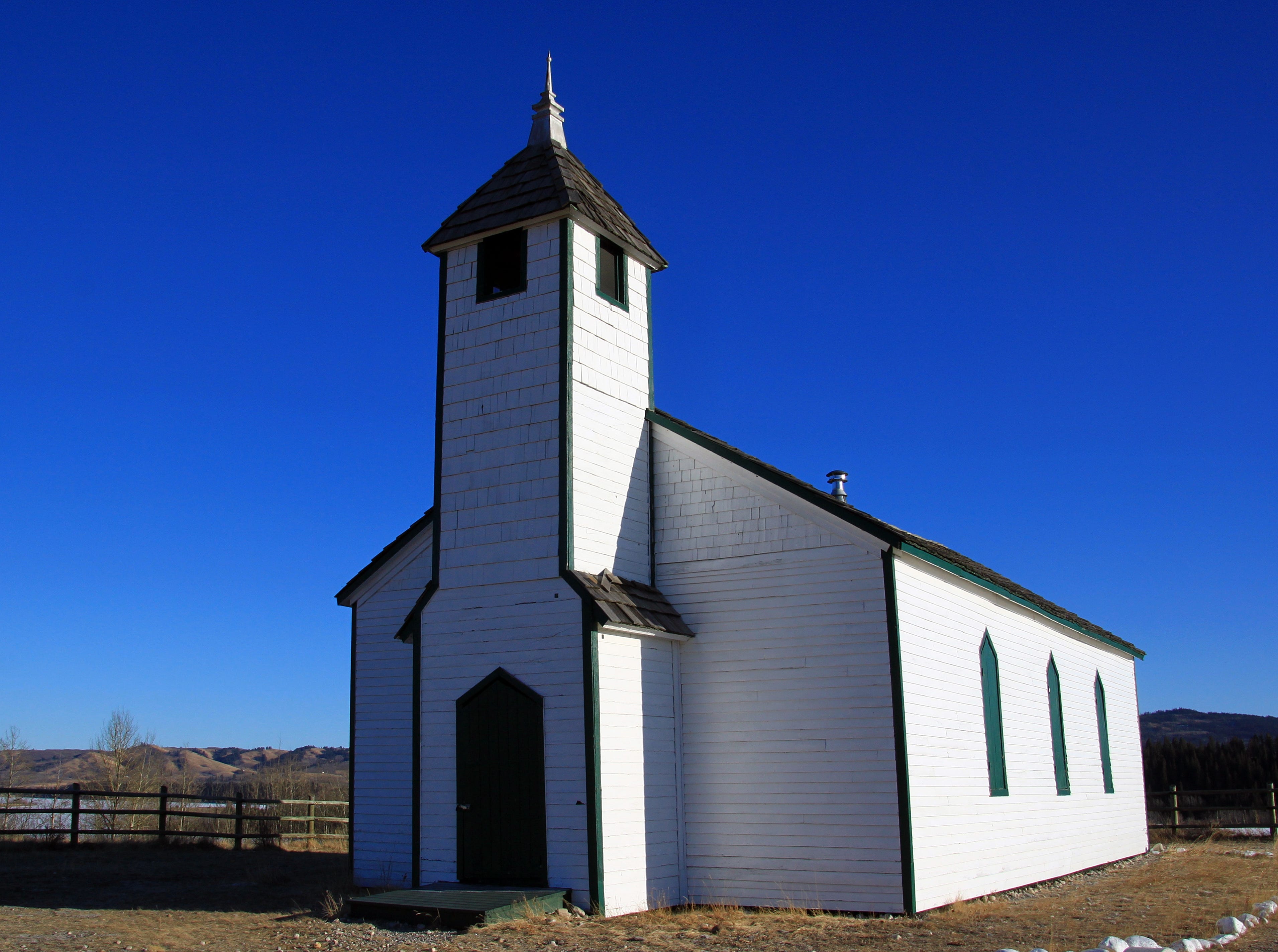
The Mcdougall Memorial United Church, courtesy of Eric Lamoureux
The neighbours to the North of our ranch have a game farm. When I was a kid they put up ten foot high fences to keep their buffalo and elk in, the wild game out. It cut right through the wagon trail. The movement and migration of herds through the valley was ironically halted by a reserve meant to protect them. My father resented the game farm and everything it stood for. He longed to see the land stay the way it was - unobstructed, at least to an extent.
Some part of me inherited that same desire. My father’s lament about the encroachment of city people towards our farm, the new houses in the area that would go up periodically, put me into a state of agony as it did him. “Bastards,” he would mutter as we drove home in his pickup truck, spotting the newest wood house frame going up 100 metres from the highway.
Over the years our farm changed too; the natural ebbs and flows of nature took their toll. Trees thick in one area would become old and fall down one by one, slowly retreating to become pasture. Areas of seedlings would sprout up to become the forest’s new heartbeat, an expanding patch of vitality. Our cows sped things up in some cases - their leisurely rubbing against trees would eventually knock them over, turning the wooded knoll to the south of our house to pasture. Regardless of the cause, I would become upset when a beloved area of forest began to thin. My dad shared my disappointment. In the cow pasture he would put up fences around certain stands of trees to save them, a bid to pause time. Eventually, they would get old and fall over anyways.
As I’ve grown older I’ve realized that as much as my Dad and I wanted the valley where we lived to stay the same, our very existence there was a mark of how much had already been lost to the people who had been here first. Our placemaking is inevitably tempered by those who came before.
When settlers arrived in Canada, the placemaking of Indigenous people was undone, erased, used up. Wolves and buffalo disappeared due to over-hunting, while foxes and coyotes thrived on the abundance of mice that multiplied in the straw that was left in settlers' grain fields. According to Donald G. Wetherell’s book Wildlife, Land, and People: A Century of Change in Prairie Canada, settler activities of “breaking the land for cultivation was literally the breaking of one natural world and its replacement with another.”
We create places that we feel reflect us - our interests, our values, our material ways of being. But what happens when a place does not reflect everyone? Or when one form of placemaking is prioritized over another? Whose place is memorialized, whose is buried?
Maybe the reason why I’ve always held the land I grew up on so tightly is because I’ve always known deep down, since first seeing the wagon trail in the valley as a child, that it wasn’t really mine to begin with. Maybe our attachment to the places we make is more than just a part of how we understand ourselves - maybe it’s a fear that we too will be forgotten. That the places we hold dear will be erased, as we erased those of First Nations.
I love the land I was raised on, and I hope to one day move back. But I'm also aware that my ability to return to a place made by my kin, a place that is entwined with my identity, is a privilege that much of Canada’s First Nations have been robbed of.
“Remove not the ancient landmark, which thy fathers have set." This is the old-testament Bible proverb which hangs on a board above a path that once led to the front door of McDougall Memorial United Church. It’s written in english and Stoney-Nakoda.
Last fall, the Province of Alberta granted the McDougall Stoney Mission Society approval to begin reconstruction of the building. It’s slated to be finished at the end of this year.
- Kylee Pedersen is a writer and editor usually based in London. She writes about food, the environment and travel, among other things.
Place recommends:
A reading list on Black people, porches and politics,
The colors of a midnight swim in Scotland,
Singing for a dictator’s orchestra,
And a dispatch from one of the world’s oldest music festivals.
Stay tuned for next week’s dispatch.